 11
11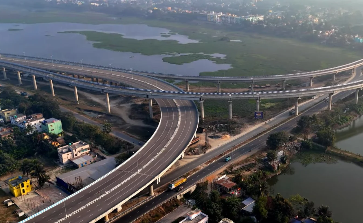
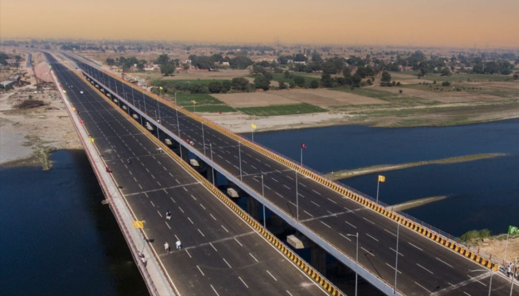
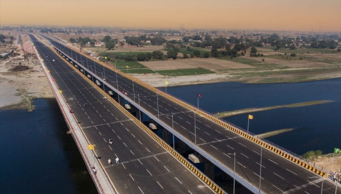
The Kalyani Expressway is a tolled expressway in West Bengal that connects Kolkata with its satellite city Kalyani. It starts from the Belghoria Expressway at Nimta, near Kolkata’s airport, and ends at Bansberia in Hooghly district. It was designed to bypass congested roads like NH 34, and it has helped turn Kalyani into a hub for education, industry and real estate. It is managed by the Kolkata Metropolitan Development Authority (KMDA) and developed by the West Bengal Highway Development Corporation (WBHDCL). The route bypasses congested corridors like BT Road and Jessore Road and gives faster access to northern suburbs such as Sodepur, Barrackpore, Naihati, Kanchrapara, Barasat, Madhyamgram and Kalyani.
| Detail | Information |
|---|---|
| State | West Bengal, India |
| Southern end | Nimta (near Kolkata Airport), connecting to Belghoria Expressway |
| Northern end | Bansberia, Hooghly district (per Wikipedia); some sources say Kampa, North 24 Parganas |
| Length | About 44 km officially (other sources quote about 35 km to Kampa, or 50-54 km including link roads) |
| Districts | North 24 Parganas, Nadia, Hooghly |
| Lanes | 6 lanes on the main carriageway, 4 lanes in low-traffic stretches, plus service lanes |
| Maintained by | Kolkata Metropolitan Development Authority (KMDA) |
| Developer | West Bengal Highway Development Corporation Limited (WBHDCL) |
| Type | Tolled expressway |
| Key bridge | Ishwar Gupta Setu over the Hooghly River (a second bridge is under construction) |
| Car toll (one way) | Roughly ₹40-60 (unofficial; verify) |
| Speed limits | Reportedly 80 km/h for cars, 60 km/h for heavy vehicles |
The expressway runs north from Nimta in Kolkata through North 24 Parganas and Nadia into Hooghly district. Major junctions include:
The Kalyani Expressway crosses the Ishwar Gupta Setu, connecting NH 12 with NH 19. The bridge crosses the Hooghly River between Bansberia and Kalyani. The Second Ishwar Gupta Setu is an under-construction 714 m extradosed cable-stayed bridge carrying the expressway.
Sources disagree because the corridor has been described in different sections. Wikipedia gives 44.17 km, 6-laned. The WBHDCL project pages describe the corridor as running to Kampa at chainage 35.34 km, and some private sources quote 50-54 km depending on where they start and end the measurement. For trip planning, use about 44 km as the expressway’s main length and check your exact start and end points on a map.
The WBHDCL is executing a project to widen the road and link it with the Belghoria Expressway. Phase I covers a 6-lane elevated connector between Belghoria Expressway and Kalyani Expressway, including widening from Nimta to Muragacha (total 4.565 km). Phase II upgrades the rest of the corridor to Kampa. Completion dates have slipped before, so check for current status if it affects your trip.
There is one main toll plaza, near the Kalyani end. One unofficial source puts the one-way toll for private cars at roughly ₹40 to ₹60, with heavy commercial vehicles around ₹120 to ₹200. Another toll calculator lists a total of Rs 60 for a car on the Kolkata–Kalyani route. A third listing shows Rs 0, so third-party figures are inconsistent. Cash and FASTag are both reportedly accepted, but carry a working FASTag anyway. Confirm the current rate at the plaza or with WBHDCL before you travel.
Where does the Kalyani Expressway start and end?
It starts at Nimta near Kolkata Airport, connecting to the Belghoria Expressway, and runs north to Kalyani, ending at Bansberia (per Wikipedia) or Kampa (per project documents).
How long is it?
About 44 km per Wikipedia, though other sources give 35-54 km depending on the section counted.
Is it a toll road?
Yes, with one main toll plaza near Kalyani.
How much is the toll for a car?
Roughly ₹40-60 one way, but unofficial sources vary, so verify locally.
Which places does it connect?
Sodepur, Barrackpore, Naihati, Halisahar, Kanchrapara and Kalyani, plus links to NH 12, NH 19, SH 1 and SH 2.
How long does Kolkata to Kalyani take by road?
Around 50-55 minutes from central and northern Kolkata in light traffic. Third-party planners show about 51-54 minutes for a 53-55 km drive, but peak hours take longer.
Can I get to Kalyani without a car?
Yes. Trains run from Sealdah and Dum Dum to Kanchrapara and Kalyani, and there are bus options too.
Why is it important?
It relieves congestion on NH 34 (BT Road) and Jessore Road, and supports commuters and freight to northern Kolkata suburbs and Nadia.