 111
111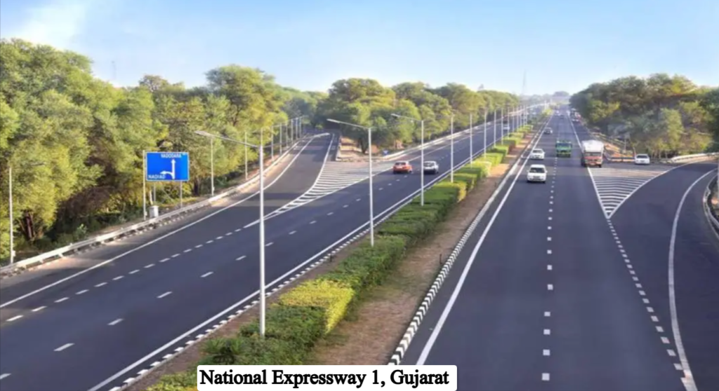 2
2 3
3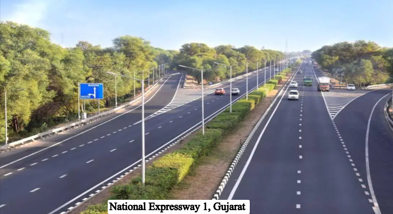
National Expressway 1 (NE-1) is the Ahmedabad-Vadodara Expressway, also known as the Mahatma Gandhi Expressway or Baroda Express Highway. It is described as India’s first national expressway, connecting Gujarat’s two largest cities through the industrial and dairy belt of central Gujarat. It was opened on August 16, 2004, and the first section was inaugurated by then Prime Minister Atal Bihari Vajpayee. It cut travel time between the cities from about 2.5 hours to roughly one hour. The NHAI maintains it.
| Detail | Information |
|---|---|
| Official name | National Expressway 1 (NE-1), Ahmedabad-Vadodara Expressway |
| Also known as | Mahatma Gandhi Expressway, Baroda Express Highway |
| State | Gujarat |
| Length | About 93 km (93.1 km per Wikipedia; NHAI toll length 93.302 km) |
| Ends | Ahmedabad (north), Vadodara (south) |
| Opened | August 16, 2004 |
| Maintained by | NHAI |
| Access | Fully access-controlled, no at-grade crossings |
| Exits | Nadiad and Anand |
| Lanes | Four lanes, with six-lane upgrade under planning (some sources describe it as six-lane) |
| Speed limit | Reported 80 km/h |
| Toll (car, one way) | About ₹125-155 (sources vary) |
| Banned vehicles | Two-wheelers |
| Travel time | About 1 hour |
| Travel time before | About 2.5 hours |
NE-1 runs broadly north-south through central Gujarat. Wikipedia lists Ahmedabad (junction with NH 47/NH 48) as the north end and NH 48 in Vadodara as the south end, with intermediate junctions with SH 12 at Nadiad, SH 60 at Anand and NE 4 in Vadodara. Travelers can expect the following:
It also forms a segment of the wider Delhi-Mumbai corridor along the old NH 8 alignment.
The expressway is about 93 km long. The NHAI toll information lists a tollable length of 93.302 km for the Ahmedabad-Vadodara stretch, while Wikipedia gives 93.1 km.
One guide gives 80 km/h, and two-wheelers are not allowed. Other sources describe the road as six-lane with higher design standards, but the posted limit is what counts, so follow the signs. Speed limits can differ by vehicle type.
NHAI lists a toll plaza on the stretch at km 86 near Vadodara, with fees effective April 1, 2025 and a revision due by March 31, 2026, so rates were likely revised in April 2026. A 2024 guide put the car toll at Rs 125. A June 2026 guide puts the one-way toll for cars and jeeps at roughly ₹130 to ₹155, depending on the plaza and revisions. Heavier vehicles pay more. Check the NHAI toll information site or the plaza for the exact current rate for your vehicle, and keep a working FASTag.
Why is it called NE-1?
It was the first national expressway project by NHAI, hence NE-1.
How long is it?
About 93 km.
How long does the drive take?
About one hour end to end in normal traffic, down from roughly 2.5 hours before the expressway.
Where are the exits?
Nadiad and Anand, in addition to the two terminal points.
Is it a toll road?
Yes, and rates are revised periodically, usually each April.
How much is the car toll?
Around ₹125-155 depending on the source and year. Verify at the plaza.
What vehicles are prohibited?
Two-wheelers are not allowed.
Is it six lanes?
Descriptions vary. It has traditionally been four lanes, with a six-lane upgrade awarded to IRB Infra and reported as still in planning, though some newer guides call it six-lane.
Who maintains it?
NHAI.